
Louisiana's Flood History: At a glance
The beautiful state of Louisiana has a total square mile count of 51,843. 8,277 square miles of that total are bordering water, this includes many lagoons, rivers, bayous and lakes. Louisiana’s main waterway, the Mississippi River has a habit of flooding and then draining into the Gulf of Mexico, the water commonly flows through the heart of the Mississippi Delta. This area is approximately just 100 miles southeast of the city of New Orleans.
As a whole, Louisiana is made up of plains divided into three geographic sections: the East Gulf Coastal Plain, the Mississippi Alluvial Plain, and the West Gulf Coastal Plain. This means that much of Louisiana lies at close to sea level making damage from flood events a very real possibility. In fact, the highest point in the state, Driskill Mountain which sits close to the Arkansas border, is a mere 535 feet above sea level. Some areas actually sit below sea level; the lowest point of the state - 8 feet below sea level - is in New Orleans.
Major Rivers:
- Atchafalaya River
- Mississippi River
- Ouachita River
- Red River
- Sabine River
Major Lakes:
- Calcasieu Lake
- Catahoula Lake
- Lake Maurepas
- Lake Pontchartrain
- Toledo Bend Reservoir
- White Lake
The Plains
East Gulf Coastal Plain - this marshland plain encompasses the area north of Lake Pontchartrain and east of the Mississippi River. Most of the area is lowlands, but rises to rolling hills in the northern-most part.
Mississippi Alluvial Plain - the most bountiful plain of the three, the Mississippi Alluvial Plain runs adjacent to the Mississippi River from Arkansas down to the Gulf of Mexico and is distinguished by hollows and ridges. Much of the soil is made up of silt and clay. The fertile Mississippi Delta is part of this plain.
West Gulf Coastal Plain - To the west of the Mississippi Alluvial Plain is the West Gulf Coastal Plain which consists of barrier beaches along the Gulf of Mexico, marshland that extends nearly 20 miles inland, and the Louisiana Prairies the furthest north. Driskill Mountain is part of this plain.
River Flooding
1927 - The Great Mississippi Flood

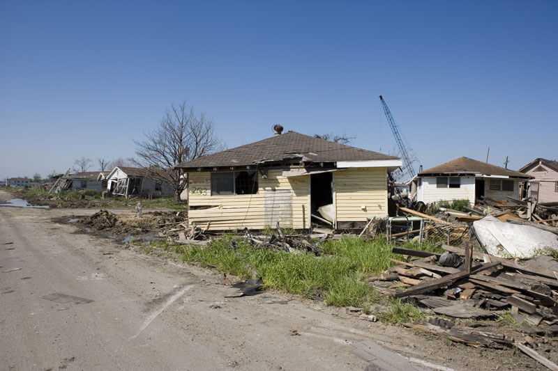
Described by Herbert Hoover, then the U.S. Secretary of Commerce, as "the greatest peace-time calamity in the history of the country," the Great Mississippi Flood of 1927 impacted over 16 million acres in seven states including Kansas, Oklahoma, Illinois, and Louisiana. Caused by excessive rainfall that ran from the summer months of 1926 all the way through the spring of 1927, the flood caused significant devastation along the river's route. In total, more than 245,000 homes and businesses were damaged by flood waters, the death toll ranged from 250 to 500, and the damaged reached well beyond $400 million dollars.
In Louisiana, a total of 10,000 square miles spread over 20 parishes lay submerged beneath flood waters. New Orleans, itself, saw 11.16 inches of February rainfall, a far cry above the normal average of 4.4 inches. The rainfall was unceasing through March and the first half of April. On the 15th - Good Friday, as it turned out - in excess of 14 inches deluged the city and overwhelmed the city's drainage pumps.
At this point, none of the levees were breached, but neither did they let the water in the city drain which essentially put pressure on the levees from both sides since the Mississippi River was also steadily rising. This prompted residents of the Crescent City to buy boats and start stockpiling food.
With the levees in such a precarious position, a decision had to be made to either do nothing and risk New Orleans flooding from a levee break upstream or manually breach a levee downstream to drain the city. Governor O.H. Simpson opted to manually breach a downstream levee to create an alternate route to the Gulf of Mexico. On April 29, destruction of a levee at Caernarvon, a city just shy of 20 miles southeast of New Orleans, began. 10 days later, a waterway was created which routed excess water from the Mississippi River.
This course of action had far-reaching consequences. 10,000 residents of the area that would be flooded once the waterway was opened had to be evacuated, the vast majority of whom lost everything. To add insult to injury, the manual destruction of the levee proved to be unnecessary since the levees eventually experienced a breach on their own which helped remove pressure on the New Orleans levees. Areas to the south were not in the clear yet as was seen when levees on the Atchafalaya River and at Bayou des Glaises were breached. The water that poured through these breaches merged north of St. Landry Parish's Port Barre. Arnaudville, Beaux Bridge, St. Martinville, New Iberia, Jeanerette, Franklin, and Morgan City were all inundated with flood waters.
The month of May closed with 60,000 refugees, thousands of drowned cattle, and acres of farm crops lost as southern Louisiana was formed into a lake that spanned between 50 and 100 miles wide and 200 miles long. The flood waters didn't begin to empty into the Gulf of Mexico until June.
1973 - Lower Mississippi Flood - March - May
Not since the Great Mississippi River Flood of 1927 had such a large volume of water flowed down the Mississippi River. The Bonnet Carre Spillway was opened from April 7th through June 14th to release the excess water into Lake Pontchartrain. The Morganza Spillway was also utilized for the first time from April 19th through June 13th which diverted water from the Mississippi to the Atchafalaya Basin and into the Atchafalaya River.
1983 - Lower Mississippi Flood
The lower Mississippi Flood in May and June of 1983 ranks second for the most destructive flood since 1927. Red River Landing in Pointe Coupee Parish sustained flooding lasting 115 days. The Bonnet Carre Spillway in St. Charles Parish was opened for 35 days to let water drain into Lake Pontchartrain and further into the Gulf of Mexico. Many flood stage records were set: On May 29th, the river crested at 33.30 feet in Donaldsonville, on May 31st, it reached 43.90 at Baton Rouge. Damages were estimated at $15.7 million.
2011 - Great Mississippi Flood of 2011
The April and May floods of the Mississippi River began with two large storms that dropped record-breaking levels of rain on the Mississippi River watershed which stretches from the Allegheny Mountains westward to the Rockies and includes 31 states, either in total or in part, and 2 provinces in Canada. When this rain mixed with the annual spring snowmelt, record river levels were experienced from as far north as Illinois and Missouri all the way down to Louisiana. Thousands were evacuated out of concern for historic flood possibilities and for the first time since the 1973 flood, the Morganza Spillway was opened to divert the excess river water. This saved most of Baton Rouge and New Orleans from being inundated, though it did purposefully flood 4,600 square miles of the Louisiana countryside in order to do so.
The Bonnet Carre Spillway was also utilized to reduce water levels near New Orleans and to help maintain the integrity of the levees that safeguard the city. They were opened on May 23rd and fully closed by June 20th.